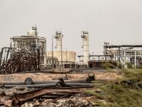
One of the most problematic tasks in the oil industry is the off-shore drilling and producing of oil. Norway’s oil industry is completely based on off-shore facilities. No wonder that the depth behavior of fluids is a prime study target.
The Statoil core (Score) programme has encouraged the group's specialists to pool skills for a better grasp of sub-surface conditions. Ultra-modern tools allow them to delve deep into geological formations.
The Statoil core (Score) programme has encouraged the group's specialists to pool skills for a better grasp of sub-surface conditions. Ultra-modern tools allow them to delve deep into geological formations.
Staff geophysicist Morten Rye-Larsen can study exploration acreage operated by Statoil off Nigeria from head office in Stavanger in order to plan a fourth well in deepwater block 218.
Pressing a key brings up a digital image of the relevant structures from the new OpenWorks database on his monitor, with information integrated from all relevant disciplines.
Seismic lines, faults and well paths are displayed in color. Warm tones could indicate hydrocarbon-bearing rocks, he explains, while curved lines are likely to be pockets of oil or gas.
Acquired last autumn, the OpenWorks integration platform allows all specialist disciplines to cooperate in interpreting an area – regardless of their geographical location.
And it encourages geologists, geophysicists, reservoir engineers and well experts to talk about "our work" rather than "mine and yours".
Statoil ranks as the first offshore operator to adopt this type of computer tool and mode of working for its sub-surface specialists.
By this means, the Nigeria team in Stavanger can communicate fast and effectively with the drilling crew in Nigeria and analyze well results in "near real time" – almost as soon as they become available.
"Borehole data from the rig are transferred to us via satellite," says Mr. Rye-Larsen.
"Within 10 minutes, this information is combined with seismic survey results and relevant maps on our monitors."
He explains that implementation of the Score programme had moved into top gear at Statoil in late 1998 when the group’s alliance with BP Amoco – dating back to 1990 – was dissolved.
This partnership had included Nigeria, and the exploration team in Stavanger had to replace technology brought to the project by the UK oil major.
Score made a major contribution to overcoming this challenge while opening substantial new opportunities, not least in terms of daily integration of drilling and seismic data.
A cabinet in one corner of the Stavanger workroom is full of old paper drilling logs which the team used to receive every morning by telefax from the operations staff in Nigeria.
Before the sub-surface specialist could advise on the next step, they had to study the seismic information, models of possible reservoir formations and the results of any earlier wells.
Roughly 20-40 per cent of preparations for a new project were devoted to identifying all relevant data, and digging up such information on each occasion also took a lot of time.
But important input will no longer languish in a drawer. Every detail is entered in OpenWorks. Although retrieving and organizing such data remains a bit of a job, once it has been done the dataset for an area is complete and ready for permanent use.
"The positive effects of that can only increase as time goes by," Mr. Rye-Larsen emphasizes.
Decision-making becomes a much more efficient and secure process when all the disciplines share full access to the complete data package, he notes.
Given that drilling in a deepwater area like Nigeria costs roughly NOK 4 million per day, substantial savings stand to be made. The best possible sub-surface picture is invaluable when deciding whether to continue or call a halt.
Special rooms for wide-screen visualization of sub-surface data are another part of the Score programme, and can now be found at most of Statoil's offices.
The group also has ultra-modern visionariums – laboratories for three-dimensional visualization as a form of virtual reality – at head office and at its research center in Trondheim.
Throwing a complete sub-surface landscape onto a curved screen measuring up to 11 by 3.5 meters, these facilities permit a team of specialists and partners jointly to visualize results from OpenWorks. That simplifies mutual communication.
"The image draws in the viewers and fills their whole field of vision," explains Mr. Rye-Larsen. "Its big format also makes it easier to understand the spatial relationship between the data."
Making full use of the new tools called for a major spring-cleaning of existing information. Seven terabytes of data, corresponding to the storage capacity of 3 500 standard home PCs, have been checked and systematized.
Results from 25 years of Statoil operations – including roughly 3 000 wells, 30 000 well logs, 1 000 three-dimensional seismic volumes, 20 000 two-dimensional seismic lines and 20 000 seismic horizons – can now be accessed by a simple key press.
In turn, the general clear-out demanded a new standard for naming geological formations and sub-surface data on Norway's continental shelf.
This will make it easier for multidisciplinary teams to retrieve stored data which are relevant for meeting new challenges.
The new names have been utilized, for instance, in preparing Statoil's application for new acreage in Norway’s current 16th offshore licensing round.
A key role in these preparations has been played by area geophysicist Alf-Henry Meland at the group’s Harstad exploration office in northern Norway.
He and his colleagues were responsible for interpreting and evaluating deepwater blocks on offer in the Mّre area off the mid-Norwegian coast.
To achieve the best results, they have worked in small teams embracing disciplines which complement each other. This job has given them three months experience of using OpenWorks.
"We've already found it highly useful, although much of the initial involvement focused on establishing methodology and working routines," Mr. Meland comments.
He believes future projects will benefit even more from the new tools, since training is needed to get the best results and to experiment with the products.
And he says that standardizing data from a number of former computer tools through Score also makes it possible to concentrate on the most important consideration – analyzing and interpreting information. This will hopefully lead to more accurate drilling.
The first phase of Score has been completed, at a total cost to Statoil of NOK 540 million. That is NOK 180 million below budget, with both implementation and training ahead of schedule.
Such efficient execution of an information technology programme is unusual. Jarle Bّe, vice president for exploration and development technology, attributes it to good planning.
An early decision was taken to buy the software complete from the supplier and do a minimum of customization. All existing and alternative programmers were also scrapped.
With the approach being to cut out all non-essentials and to say "good enough will do", Mr. Bّe believes Score will help Statoil to maintain its leading position in reservoir management.
"We're probably a couple of years ahead of our competitors, but several other oil companies have shown interest in the programme and are following in our footsteps."
He believes Statoil's position can be maintained and enhanced through a good overview, an orderly approach and greater accuracy in drilling new production wells.
The programme has put the disciplines on the right track, he says, with a 10-15 per cent improvement in efficiency possible across the board.
"Each discipline has looked at the sub-surface from its own perspective. We're now in a position to combine these "world views" into an overall picture which absorbs the best from the originals."
By Alice طlberg Bore and طyvind Hagen (pictures)
Source:Statoil.com
© 2000 Mena Report (www.menareport.com)


