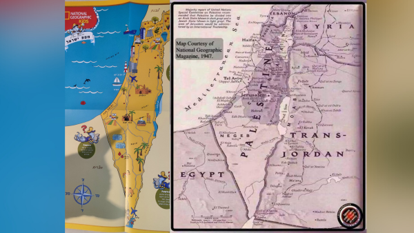
An Israeli Senior Humanitarian Law and Policy Consultant has posted a photo featuring a map of Israel as part of the Hebrew version of the National Geographic Kids magazine, one that mentioned no Palestinian existence in the whole area of historic Palestine.
Canceled my kid's @NatGeo subscription after receiving this map of #Israel, which fails to distinguish between it and occupied #Palestinian territory. It presents a distorted geographical, political and legal picture, which @NatGeo should correct forthwith. #StopAnnexation pic.twitter.com/LVdLR4juWf
— Itay Epshtain (@EpshtainItay) April 13, 2021
On his social media accounts, Itay Epshtain said he has cancelled his kids' subscription for what he said their failure to "distinguish between Israel and the occupied Palestinian territory," suggesting that it is another sign Israeli mainstream media is supporting the possible annexation of the West Bank, which is recognized as Palestinian territory placed under Israeli military occupation.
Epshtain added that the map "presents a distorted geographical, political and legal picture;" one that should be corrected by the magazine.
Why else do you think Murdoch bought it? To lie a new reality into millions of heads. It was one of the world's best sources of information on climate change too but has now been effectively gutted.
— Pig Brother (@PeterParkorr) April 13, 2021
The Israeli lawyer ended his post with the hashtag #StopAnnexation, which has been active since Israeli officials have been openly talking about their government's plans to annex the areas that include Israeli settlements in the West Bank.
According to the Israeli NGO B'Tselem, the settlements' jurisdiction and regional councils extend to about 42% of the West Bank, which threatens any future resolutions with the Palestinians on the basis of the two-state solution, Israel has agreed to during the 1993 Oslo Accords.


